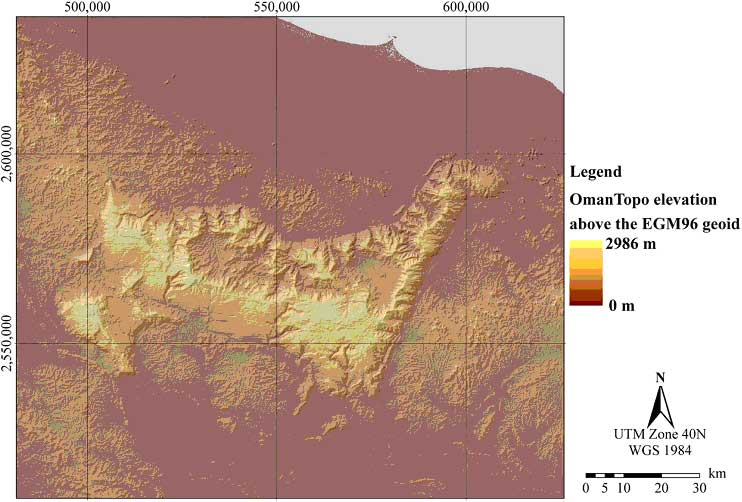
Figure 2. The OmanTopo elevation model, created by filling voids in the SRTM elevation surface with supplementary topographic information derived from Russian military maps, using a TIN-based delta surface approach © 2008 Luedeling
|
|||
Figure 2. The OmanTopo elevation model, created by filling voids in the SRTM elevation surface with supplementary topographic information derived from Russian military maps, using a TIN-based delta surface approach © 2008 Luedeling |
|||